The 10 Best Marine Chartplotters

This wiki has been updated 42 times since it was first published in October of 2016. For avid boaters, a marine chartplotter is a critical navigation tool for unfamiliar territories. Available for different budgets and useful for those in a wide variety of vessels, these devices can be used to chart a complex course across a lake at night, identify underwater structures for scuba diving, find shoals of fish, map out intricate coastline details, and help you avoid running aground. When users buy our independently chosen editorial selections, we may earn commissions to help fund the Wiki.
Editor's Notes
November 03, 2020:
In the fast-moving world of marine and navigation technology, systems are updated quickly and regularly due to the fact that the sea will never be a safe environment for people. This means that we had to make quite a few updates to our list as newer and better models and options become available at better value for money.
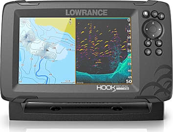
We added the Lowrance Hook Reveal Splitshot as it replaces the older model, which was first released in 2015. The auto-tuning sonar and updated transducer make it a better, less expensive choice. Similarly, the Garmin Striker 4cv is an upgrade on what is a very popular unit for small boat owners all over the world.
Even though this and some other plotters could have some crossover with fish finders many of these chart plotters have this functionality simply due to the quality of modern transducers and antennas which allow them to track fish as well as give you an accurate profile of the seabed and route to your next waypoint.
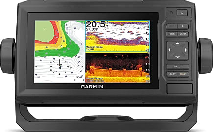
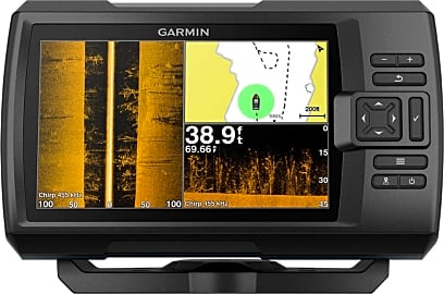
The Garmin Striker Plus 7sv has two different transducers, increased storage, and now comes with an app so you can access data from anywhere on your boat. The Garmin Echomap 63cv comes with 17.000 inland US charts and is an easy choice for inclusion on the list.
The decision to include the Raymarine Axiom Pro 12 RVX is an important one, as this remarkable plotter represents a game-changer for the industry. With the ability to map your course better than almost any other plotter in the world, it can overlay radar on your chart, so that you can check for other watercraft in the area without losing your position. It will listen for fish as well as look for them, and its touchscreen has a reputation for durability.
Modern marine navigation has come a long way from the days of the sextant, and safety in the harsh environment of the sea has never been more accessible or affordable.
April 19, 2019:
Had to remove a few items from the list due to a combination of availability and quality issues. The Lowrance Elite-4X was out of stock, while the Garmin 78sc appears to consistently frustrate users with poor resolution, unreliable GPS and mapping functions, and subpar battery life — issues that have caused problems out on the water.
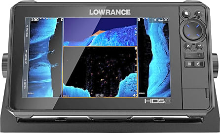
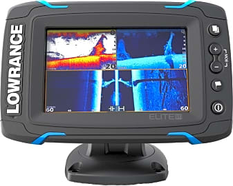
We have several new additions to the list, including two Lowrance models. The Elite-5 Ti does not feature side imaging (which can be a deal-breaker for some), but users indicate that its reliable downscanning capabilities, quick response time, intuitive menus, and WiFi and Bluetooth connectivity make it a solid option. The HDS-9 Live is a truly high-tech piece of equipment, offering incredible image clarity, advanced CHIRP sonar, and a highly accurate GPS antenna.
Also added the Garmin 44cv — while not as feature-rich as the other new models, users seem to appreciate its affordable price, straightforward operation, and precise depth readings.
Special Honors
Furuno TZTL15F More expensive than other options on our list, and the choice of professional sailors all over the world, the Furuno TZTL15F will allow you to have complete control over your navigation systems, radar, sonar, fish finder settings, and battery life. It will also monitor all of your engine data. It is as intuitive and easy to use as any modern smartphone, and this puts professional equipment in the hands of any seaman. furuno.com
Navigation, Charting, And Other Vital Functions
Its ability to generate detailed electronic charts is another area the chartplotter stands out from other navigational tools.
It would be easy to compare a marine chartplotter to the GPS devices you see attached to the dashboard of your Uber driver’s vehicle or the handheld devices some hikers utilize, but in reality, most chartplotters are even more complex than those snazzy tools. This is because, as a nautical instrument, marine chartplotters must be able to process more information and offer more functionality than your typical on-land navigation equipment.
To put it simply, the purpose of a marine chartplotter is to show you where you are and help you navigate to where you’re going. When you first look at its screen, you will see your boat's position displayed on a chart, indicating your precise location. If the size and structure of the body of water you’re on is rather small and uncomplicated, you can simply plug in a destination and a route will appear digitally on the screen for you to follow. On a large body of water with plenty of structure and complicated destinations, you can enter waypoints to build a custom route.
The chartplotter uses GPS or GNSS data to measure bearing, speed, and heading to assist with navigation. That’s great and all, but a regular handheld GPS can handle that too, right? Touché. However, the chartplotter becomes truly impressive when you get into its tracking and route navigation capabilities. The system will detect underwater details like reefs, sand banks, and other hazards, then adjust your route to avoid them. If it appears you will run into an obstruction that you can’t bypass, it will execute reverse route navigation to help you out of that sticky situation.
Its ability to generate detailed electronic charts is another area the chartplotter stands out from other navigational tools. At a basic level, you’re using this as an instrument to reproduce paper nautical charts, which commercial ships have long relied heavily upon for a variety of critical data points. A marine chartplotter will produce two types of charts: a raster chart, which is essentially a scanned version of a paper chart; and a vector chart, which is composed of lines, points, and polygons using information pulled from a database. Vector charts are more dynamic, use less memory, and are more user-friendly than raster charts.
Many models are integrated with a fish finder, which is a useful instrument for anglers that detects sound waves underwater and uses the signals to project a picture onto the screen. Fish finders provide valuable information to help identify where fish are located, such as depth, water temperature, underwater structure, and even visual icons or sound alerts to indicate the presence of fish.
Key Factors In Selecting A Chartplotter
When you begin the selection process, consider a few important questions to help narrow down your search right off the bat. What type of screen size and processing speed will you require? Where do you plan to place your unit, and will it be mounted? Do you plan to integrate your chartplotter with any other devices? Do you need a fish finder? How much are you willing to spend?
What type of screen size and processing speed will you require?
In this case, speed and size matter. If you’re a fisherman who operates a small boat, a simple chartplotter with a small screen for basic charts and measuring boat speed will probably suffice. If you plan on commandeering a large watercraft, in which case you’ll likely view your device from a greater distance as you manage multiple interfaces, a large model with a faster operating speed that allows for split-screen and zoom functionality may be the way to go.
Make sure to select a chartplotter that’s compatible with the physical design of your boat. Most models can be bracket-mounted, which is easy and gives you the flexibility to remove the unit when you’re done boating. Remember to place it somewhere that provides an unencumbered view of the screen as you navigate. Preferably, this location will protect the device from inclement weather.
It’s easy to get lost in all of the technical intricacies of these gadgets, but don’t let that cause you to overlook durability and longevity. If you’re making a significant monetary investment, you want to make sure your chartplotter is built with a quality, long-lasting design. Water resistance is key, as well, especially if you’ll be using your unit in a small, open boat that will leave it open to splashing waves and precipitation.
If the information on the screen of your device confuses you more than it educates you, it’s basically useless. Look for a unit with high marks for its user interface, as even today’s less expensive options should be user-friendly at a minimum.
The Technology Powering Today’s Devices
The marvels of modern technology never cease to amaze, and it’s no different when it comes to innovations in the maritime world. As a primary nautical navigation tool, the chartplotter relies on a wide range of sophisticated systems, from GPS and GNSS to sonar and radar.
The marvels of modern technology never cease to amaze, and it’s no different when it comes to innovations in the maritime world.
If you plan on integrating different components of your nautical communications system, you’ll need to make sure your devices meet the connectivity requirements for your situation. Check with the National Marine Electronics Association (NMEA) to review the latest standards, which pertain to how you can connect your chartplotter to a marine VHF radio, marine autopilot, steering systems, fire control systems, an AIS system, and a variety of other tools.
An automatic identification system (AIS) and a vessel traffic service (VTS) are often used in tandem with a chartplotter for collision avoidance and vessel traffic control in busy waterways. For watercrafts of all sizes, this integration helps contribute to safety and efficiency at sea.
Owners of chartplotters who enjoy fish-finding capabilities will want to ensure their unit includes a quality transducer. As the heart and soul of a fish finder, the transducer interprets sound waves to read what’s beneath the surface of the water. As the depth of the water you’re fishing increases, the level of power you’ll require from your transducer increases as well. For those of you who prefer to receive audible alerts when your transducer detects fish, you should make sure a sounder is included in the package, as well.


